Ken (OLDweeb) did such a wonderful job of honoring one of our locals, DonJ, who passed away recently and way too soon. Here’s the link –OLDweeb’s Blog;
Don made a couple of appearances here:
He will be missed by his geocaching family.
Ken (OLDweeb) did such a wonderful job of honoring one of our locals, DonJ, who passed away recently and way too soon. Here’s the link –OLDweeb’s Blog;
Don made a couple of appearances here:
He will be missed by his geocaching family.
I took an epic 11 mile hike up this fabulous scenic canyon on Aug. 23 with an intrepid band of cachers from the San Fernando Valley and Ojai! BWidget, Cachekidz!, 3rd Wheel, Feral Cat, and gsmX2 joined me for the 5 hours of dodging poison oak and breathing the fresh summer air, finding 27 caches along the way. We started at Devil’s Tongue just above the parking lot, and wound up overlooking the canyon and hillsides from Angle’s [sic] View of the Devil (Cyn). Along the way, I visited my own cache, Daniel Webster, my ammo can that got charred in the fire a few years ago.
Thanks to Scott Miller (gsmX2), we have a great video to remember the day by!
What better way to celebrate the season than with a visit to Santa Claus, Indiana?
I saved this portion of my summer road trip to publish this week. The town must look quite magical during the Christmas holiday, so my sunny photos might not do it justice.
There are several town websites to explore.
This one doesn’t have many photos: Santa Claus IN.
This site has some history: History.
a HA! This site has a photo gallery: Celebration, but not many show a winter wonderland.
I guess I’ll have to get back there some December and see if it looks more like the North Pole.
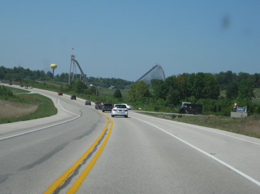
There is an amusement park there, but I only peered in from the cache location outside.
Entering the town:
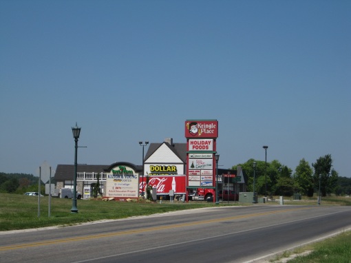
One of the two shopping centers, Kringle Place:
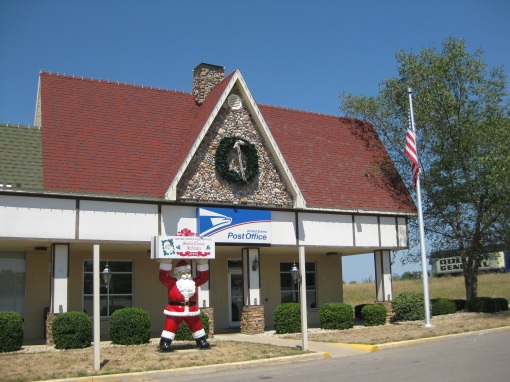
The post office, where they must receive many wonderful letters from around the world:
Town Hall:
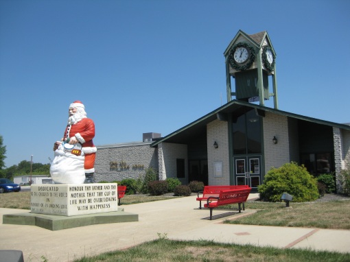
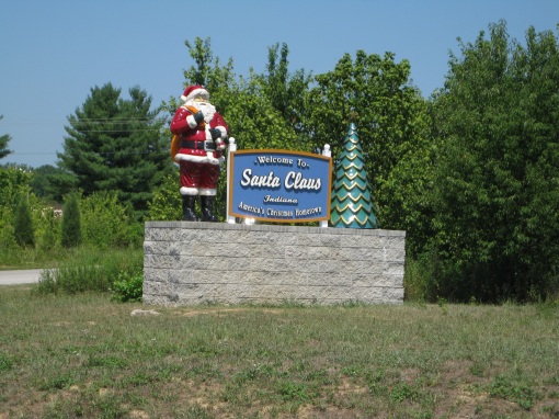
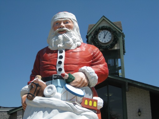
… and the man, the icon, the Santa:
May your Christmas and New Year celebrations be filled with the magic of the season and many wonderful memories for years to come.
About the same time that I started this blog, I also decided to write a book about my geocaching experiences. I finally got it done, edited, and published on Kindle today!
Virtuoso Geocaching: Finding the Unexpected

I’ll be adding photos here on my blog for each chapter, but in the meantime, enjoy reading all about the WHY of geocaching.
This book should entertain geocachers, and be perfect to hand to your muggle friends for them to get a sense of what our obsession is all about.
Please do leave a review on Amazon for me.
Bonus! Here’s my interview on local Fox 11 KTLA earlier this year:
On my way from Colorado Springs to Phoenix, I drove through some of the most gorgeous scenery on the planet. Durango was a perfect place to stay over night and get a sense of the history of the area as well. It’s a mountain mining town, and reminds me of my own home town of Yreka, CA.
I stayed at the General Palmer Hotel, built in 1898 –

The Victorian decor and atmosphere was relaxing and charming.

In the morning, I took a stroll up Main St. to find the only cache within walking distance.
THE BLACK BOX

The architecture is a classic mix of old and new.

The buildings all have basements. I note this, because they are uncommon where I live in Southern California.

Along the street there are a number of plaques with photos of highlights of the town’s past.

I’m not sure if this place is there, or if there’s someone to take a reservation… ha.

Mountain view

Another beautiful historic hotel

Next time I’m in town, I’ll have to take the train through the scenery!

Durango & Silverton Narrow Gauge Railroad Train


Subscribe for free to my blog!
Click HERE for your e-mail subscription OR
 HERE to subscribe with a reader
Follow me!
Click on each cache title to link to see its cache page.